Our Tools
Wave Flume
Physical Modeling
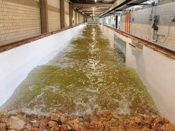
CAMERI’s wave flume is 48 meters long, 2.5 meters wide, and can be filled with 1.5 meters of water. The flume has a piston-type wavemaker with an electric drive system and is equipped with an Active Wave Absorption Control System. The flume also has an attached towing tank on which floating and submerged vessels can be tested.
Wave Basin
Physical Modeling
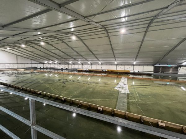
CAMERI’s wave basin is the only facility of its kind in Israel. It has an area of 50 m x 25 m and has a piston-type upgraded wave maker. The basin allows us to investigate aspects of maritime design including breakwaters, quays, and agitation models for various circumstances.
Wave Buoys
Numerical Modeling
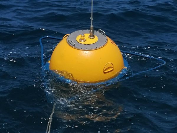
Our wave buoys, installed in Haifa, Ashdod, and Eilat, provide continuous real-time data including wave height and period, sea surface temperature, wind speed and direction, and more. The wave buoy in Eilat is also equipped with an acoustic current meter (ACM) that provides current measurements, including speed and direction, up to one meter in depth below the buoy. Our wave buoy data is available for purchase as CC files, API, and visualization tools.
Modeling Tools
MIKE by DHI is a range of software products to accurately analyze, model, and simulate any type of challenge in water environments.
WaveWatch III is a third-generation wave model developed by the National Oceanic and Atmospheric Administration (NOAA) for simulating the generation, propagation, and dissipation of ocean waves globally. It utilizes wind field inputs from atmospheric models to predict wave conditions, including significant wave heights, wave directions, and frequencies at various spatial and temporal resolutions. WaveWatch III is designed to provide accurate forecasts for maritime operations, coastal planning, and research purposes. It plays a crucial role in weather prediction, safety at sea, and in understanding and monitoring climate change impacts on ocean dynamics. The model is continuously updated to incorporate the latest scientific advancements in wave physics and computational techniques, ensuring reliability and accuracy in wave forecasting.
Delft3D FM is a modeling environment for the simulation of among other things storm surges, that shows local flows and water levels, waves, sediment transport, and more. XBeach is a model used for the computation of nearshore hydrodynamics and the morphodynamical response during storm events.
A numerical model to calculate shoreline change, wave-induced long-shore sand transport, and morphology change at inlets on a local to regional scale. GenCade is operated within the Surface-water Modeling System Interface bringing functionality to a georeferenced environment.
EPA is an application for simulating surface water jets and plumes provided by the United States Environmental Protection Agency.
Developed by a European consortium of governmental and private organizations, TELEMAC is an integrated suite of solvers for use in the field of free-surface flows. Telemac can be used to study and model various transport phenomena in coastal regions, rivers, and lakes.
SWASH (Simulating WAves till SHore) is a non-hydrostatic, RANS (Reynolds Averaged Navier Stokes) type wave-flow model. The solver is used for predicting surf zone and swash zone dynamics, agitation in ports and harbors, rapidly varied shallow water flows (e.g., dike breaks, tsunamis, and flood waves), and density–driven flows.
OpenFOAM (Open Source Field Operation and Manipulation) is a library of continuum mechanics solvers (i.e., fluid and solid body dynamics). In CAMERI, OF is used to study and model Fluid-Solid Interactions of floating structures and marine vessels, buoyant turbulent–jet flows such as desalination and power plant outfalls.
CAMERI researchers use Technion’s ‘ZEUS’ HPC cluster. ZEUS is comprised of 24 nodes (totaling 940 cores), utilizing 9216 GB with 200GBps InfiniBand connectivity.
Surfer by Golder Software is a powerful contouring, gridding, and surface mapping package.
